
Climate & Environment
Catastrophic Flash Flooding in Texas Hill Country: A Hydrologic System Strained
Intense, stationary convective storms have triggered fatal flash flooding across the Texas Hill Country, highlighting the region's acute hydrologic vulnerability.

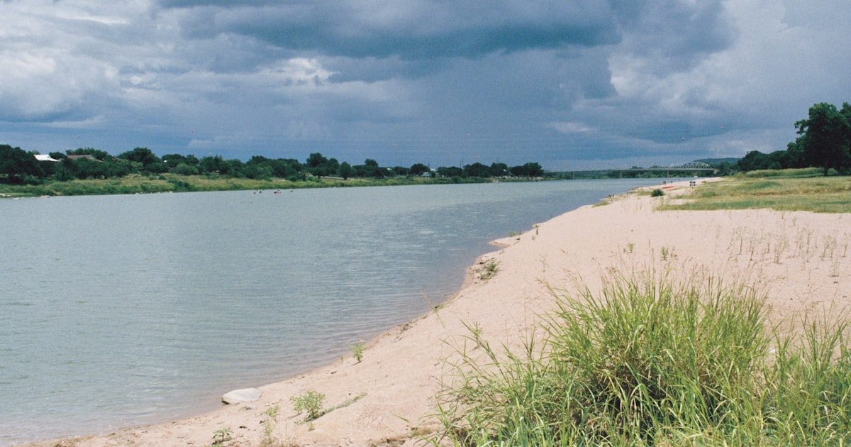
Heavy rainfall concentrated over the Texas Hill Country has triggered catastrophic flash flooding, leading to at least two confirmed fatalities and significant infrastructure damage. The event, which developed rapidly over the last 24 hours, underscores the extreme vulnerability of the region’s rugged, limestone-dominated landscape to high-intensity precipitation events. As recovery operations begin, the focus remains on the ongoing threat posed by saturated ground and elevated water levels across major basins.
The Atmospheric Event
Meteorological data indicate that a stagnant, moisture-rich air mass, characterized by exceptionally high precipitable water values, became locked over central Texas. Convective systems—clusters of thunderstorms capable of producing localized but intense rainfall rates—repeatedly formed and traversed the same area, a phenomenon often referred to as "training."
The Hill Country geography acts as a force multiplier for such events. With its steep topography and relatively thin soil cover over fractured limestone, the region offers limited infiltration capacity. When intense rainfall occurs, the majority of the water is converted rapidly into surface runoff, converging into the complex network of creeks and rivers that drain the region. This transition from atmospheric moisture to localized surface inundation is rapid, leaving minimal lead time for those within flood-prone areas.
Hydrologic System and Vulnerability
While individual flash flood events are weather events—defined by their duration, intensity, and location—the susceptibility of the Hill Country to these occurrences is a systemic feature of its hydrologic and topographic profile. The region is widely recognized as one of the most flash-flood-prone areas in North America.
The interplay between the geography and land use is critical. Natural features, including narrow valleys and steep drainage basins, dictate how water moves through the system. Human infrastructure, particularly the density of low-water crossings and road networks built into valley floors, fundamentally alters the impact of these events, transforming a natural hydrologic process into a disaster involving high risk to life and property.
In recent years, the region has been subjected to varying precipitation regimes. While the long-term trend analysis for central Texas rainfall requires a robust, long-period baseline to filter out natural variability—such as the influence of the El Niño-Southern Oscillation (ENSO)—the observed frequency and intensity of short-duration, high-intensity precipitation events in parts of the southern United States remain a focus of active meteorological research.
Impact and Infrastructure
Initial reports confirm at least two deaths directly linked to the rising floodwaters. Emergency management officials are currently overseeing water rescues and assessing the extent of damage to secondary roads and bridges. Local authorities have emphasized that many of the road closures are due to debris, submerged surfaces, and structural integrity concerns.
The impact of such events is highly dependent on local exposure and preparedness. In the Hill Country, the risk is often compounded by the time of day, as heavy rain falling overnight significantly reduces the effectiveness of visual warnings. Official warnings, issued by the National Weather Service, have highlighted the extreme, life-threatening nature of the flooding in affected basins.
Quantified Uncertainty and Official Data
Precision in estimating total rainfall across the region is inherently limited by the spatial heterogeneity of the convective systems. While automated gauges provide point-in-time data, they do not always capture the peak intensities experienced between monitoring sites. Satellite-estimated rainfall products, while useful for broader situational awareness, carry their own inherent uncertainties and must be calibrated against ground-based observations to be considered accurate for official record-keeping.
As the system moves out of the area, the National Weather Service and local water authorities are transitioning from active emergency operations to damage assessment. The current flood stages and discharge rates remain above normal, and any additional precipitation in the coming days could lead to renewed localized flooding, given the already near-saturated state of the drainage basins.
Public Safety and Preparedness
Official guidance from emergency managers remains clear: motorists should never attempt to cross water-covered roadways. The force of moving water is often underestimated, and structural failures beneath the water surface can occur without prior warning. As the region moves into the recovery phase, the public is encouraged to monitor updates from local authorities, who are the definitive source for road status, emergency resource locations, and secondary hazards.
While this event is catastrophic for those impacted, it is also a reminder of the inherent hazards within this specific geographic landscape. Understanding the distinction between the weather event—the convective rainfall—and the system—the susceptibility of the Hill Country to rapid hydrologic response—is essential for public safety and the continued resilience of infrastructure in the region.
Sources
- National Weather Service. (2026). Weather Forecast Office Austin/San Antonio - Flash Flood Warnings and Alerts. https://www.weather.gov/ewx/
- CNN. (2026). At least 2 dead in catastrophic flooding in Texas Hill Country. https://www.cnn.com/2026/07/17/us/texas-hill-country-flooding/
- Texas Division of Emergency Management. (2026). State Operations Center Situation Reports. https://www.tdem.texas.gov/
Shadowfetch is a technology publication. Explore Shadowfetch Linux — our own Linux build — and the Shadowfetch apps on the App Store.
Sources
The article cites National Weather Service warnings, emergency management officials, local authorities, and initial reports, with source links listed at the end.
Evidence types: official warnings, emergency management reports, local authority guidance, initial reports
Links verified
See a problem in this story? Report an error · Corrections policy · Our methodology
The Daily Newsletter
One morning email: the day’s biggest technology stories — AI, new devices, and the companies shaping them.
Related coverage
 Climate & Environment
The Attribution Threshold: Moving Beyond Binary Climate Causation
Chris Paterson ·
 Climate & Environment
The North Atlantic Heat Anomaly: A System in Transition
Chris Paterson ·
 Climate & Environment
Flash Flood Risk Targets New York, New Jersey and Southern New England as Slow-Moving Storms Train Over the Northeast
Daniela Imani Reyes ·